The Walk to Kuranda
A shamelessly recycled email which I have not bothered to edit very well.....
Hi everyone
Sorry I've not been in individual contact much lately, pressure of study and
all that.
Anyway, this is the start of what will probably end up being a boring little
series, pleas let me know when it reaches that point.
We have decided to take up bushwalking and by way of preparation (read
strengthening our legs) we are trying out all the old aboriginal (or Bama)
foot trails up the hills out of Cairns.
Last week we walked a significant section of the Douglas track that goes to
Speewah (well the uphill bits anyway, we piked on the flat 6km walk to speewah
on the grounds that there is nothing there)
This week, we went to Kuranda via the aptly named "Smith's track".
Smith's was the way all the early settlers in the Kuranda area got to and from
the town of Smithfield (Cairns having not yet been established) and when the
railway was finally built, it actually follows the original track which goes
to show that aboriginals had a fine eye for determining the most reasonable
grades (just as important for out of condition walkers as it is for trains).
I've actually walked Smith's track twice before, once about 20yrs ago and more
recently in the last couple of years. What astounds me is the constant removal
of artefacts and the way in which the rainforest can heal sings of human
interference. Twenty years ago the remanent of the settlement of Barron Falls
could be clearly seen, even tot he extent of being able to see overgrown house
gardens and non-native trees. The only thing evident now is some bamboo
planted by the Chinese, a lot of "mother-in-law-tongue" and some
cacti.
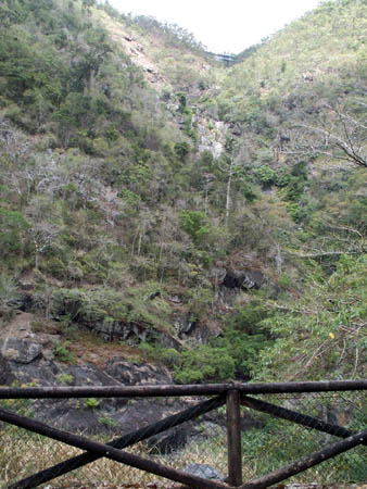
Anyway, on with the show. The track leaves from just behind the Barron falls
power station (the toilet block actually) and climbs brutally (any other
interpretation of over 1,000ft in under 1.6km is welcome) and intersects the
railway just north of the stony creek bridge.
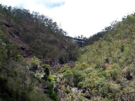
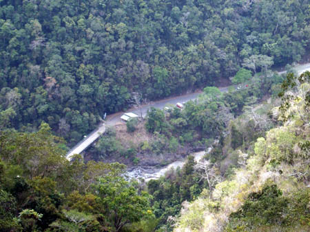
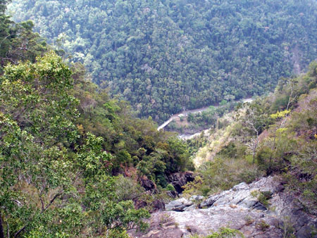
The bridge is a good photographic target to give you an idea, the following
two photos were taken at the public car park, one is zoomed a bit and the
other isn't to show scale.
The bridge is in the "valley" at the top of the photo above.
Here's a better view:-
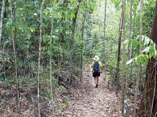
The first thing that hit both of us (Sylvia has walked this one as well), was
how dry it was. Even a couple of years ago at the height of a dry season when
we went up this track the ground was wet and the leaf litter was wet and
rotting down. Not so today , look at the piled leaf litter on the ground, it
is tinder dry and will just explode if it gets a match in it.
Even the famous ferns that normally overhang most of the railway up to Kuranda
are dead from lack of rain
Anyway, we puffed and panted but we got to the top, here's a couple of shots
back down to where we came from, you can just make out the Kombi in glorious
solitude in the car park.
Zoomed:-
Un zoomed:-
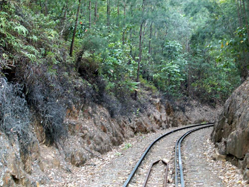
From here we walked 4 very hot kilometres into Kuranda and had a cup of tea at
the railway station before walking back. Walking on the train line is of
course highly illegal, we simply had a listen on the line to ascertain that
nothing was coming up behind us. In Kuranda we found out the departure time of
the train and arranged to be well gone before it, although we did end up
having to quickly hide when the little modified 4wd that QR use for line
checking came zooming up behind us, still we hear dit coming with about 30
secs warning.
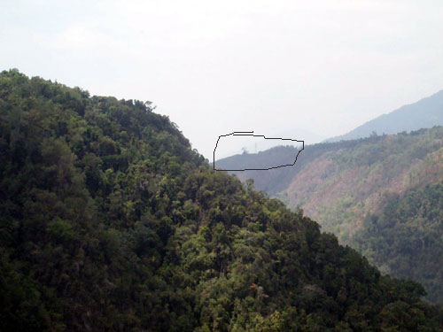
I couldn't help taking a long distance smoky shot of Red bluff which was were
we turned off the Douglas track last week. I've pout a rough circle around it,
was the track used by the community of Stony Creek to access the flat lands.
Stony Crk was a thriving little community during the building of the rail
line, it was important enough to have its own rail station and goods siding,
some of which still remains. For someone like me who is interested in history
its an interesting place to visit as there was never any road access to it
which has greatly slowed the unfortunate removal of historical artefacts. I'm
planning to go there again soon, Sylvia will not go with me as it entails
walking through several railway tunnels (including one no longer used) and she
refuses to do this.
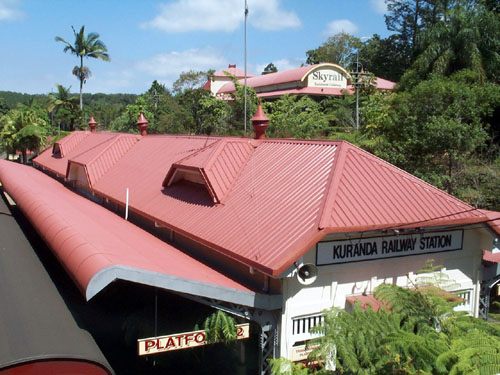
Lastly a shot of Kuranda station with Skyrail in the background. We did
briefly think about hitching a ride down but decided it wasn't in the spirit
of the adventure. We left at 1:35 knowing that the train left at 3:30. We
made it to the car at 3:20 so we made pretty good time for 4 km on the flat
and 1.6 steeply down hill. Too late I remembered that it is a good idea to cut
your toenails very short if walking on hills, it is excruciatingly painful to
have your nails driven back into your toes by your feet sliding forward in
your shoes which is kind of inevitable walking downhill.
Next Sunday we are going on a goldfields walk in Goldsbrough valley (on the
flat for a change), anyone local is welcome to join us.
Click your browser's "back" button or click here
to go back.